The Submerged Cemetery at Mullins Cove
commonly referred to as: Long Cemetery #2
By 1807, Henry Long was living in Jonesborough, Tennessee after moving from Virginia. But, Henry wasn’t satisfied living in Jonesborough. His sights were set deeper into this newly formed state. Tennessee had been admitted into the Union only 11 years earlier. Opportunities here were plentiful.
Henry Moves to Mullins Cove
Henry, along with two companions, boarded a crudely designed raft. They were swept past the confluence of the Holston River and French Broad River. These two rivers form the headwaters of the Tennessee River. Of course, back in those days the river was still known by such names as The Hogoheegee and The Great River of the Cherokee.
 Confluence of the Holston and French Broad Rivers
This was an unmanaged river. There were no dams back then to stem its flow. The river flooded with spring rains and nearly dried up with summer droughts. Henry navigated his craft downstream past Knoxville and Chattanooga. Chattanooga was a Cherokee trading outpost at the time.
Henry initially settled in the Sequatchie Valley where he operated a successful Livestock Trading Business.
Mullins Cove – Marion County, Tennessee
By 1811, Henry and his new bride Zilpha moved to an area of Marion County known as Mullins Cove where they acquired 2000 acres. From the tall mountaintops down through the fertile bottom land they hacked their way through thick canebrake that inundated their land. Here, they successfully raised a family and continued with their stock trading operations.
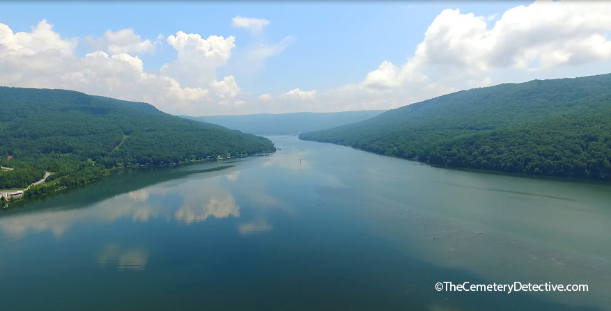 Mullins Cove (in the distance) from the Tennessee River
Zilpha Buried in a Cemetery on Dry Land
Zilpha passed away in 1860. She was buried in a small cemetery on their land. This cemetery was on a slight hillrise about 1/4 mile from river’s edge. Henry died in 1875. He was buried alongside Zilpha. As generations came and went, some of their descendants were buried there, too. For example, Henry and Zilpha’s great grandson Moses Merritt Long was buried in the cemetery in 1881 after dying at only 3 months of age.
The land stayed in the family but big changes were coming to this area. There was a need for improved river navigation. There was also a need for electricity for the burgeoning population of Euro-Americans who were streaming into the area.
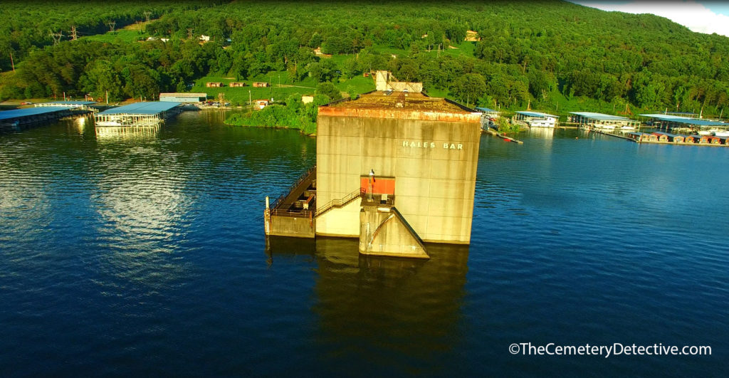
Hales Bar Dam on the Tennessee River
By 1905, Chattanooga businessman and engineer Josephus Guild had begun construction of the first multi-purpose hydroelectric dam built across a navigable waterway by private industry. His company, The Chattanooga and Tennessee River Power Company devised this dam for a two-fold purpose. The dam would improve river navigation along a treacherous stretch of river known as the Tennessee River Gorge and it would also provide electric power to the burgeoning population of Chattanooga, Tennessee. This dam was located across Hales Bar; about 5 miles downstream of the cemetery.
A Cemetery Underwater
By 1913 Hales Bar Dam opened for operations. The lake level behind the dam rose to 626.2 feet MSL (above Mean Sea Level). By the 1920s, The Chattanooga and Tennessee River Power Company had merged with several other companies to form a new company called Tennessee Electric Power Company (TEPCO). TEPCO desired to increase the operating capacity of Hales Bar Dam by fastening flashboards across the crest of the dam. These flashboards raised water levels in the upstream lake by an additional 3 feet to 629 feet MSL.
It is unclear whether lake waters were lapping at the cemetery’s perimeter at this time or if the cemetery was already completely under water by the 1920s.
As it stands today, the ground surface of the cemetery appears to be approximately 631′ MSL. However, mechanical action of river currents cause silt to move from upstream locations toward downstream locations where natural collection occurs. The damming of the river caused this silt to collect in such areas as Mullins Cove. Considerable silting has taken place over the decades. Because silting raises ground levels, it is entirely possible the cemetery’s elevation was lower in the 1920s than it is today. This means the cemetery might have already been flooded in the 1920s after the lake level was raised to 629′ MSL.
Tennessee Valley Authority – Hales Bar Dam
In 1933, The Tennessee Valley Authority came into existence. Plans were quickly devised to acquire Hales Bar Dam. By 1939, after that transaction was complete, TVA owned and operated the dam.
TVA had bigger plans for Hales Bar Dam. As part of TVA’s mission to further improve navigation along the Tennessee river, TVA sought to deepen the navigation channel between Hales Bar Dam and the newly built Chickamauga Dam 33 miles up stream. Prior to 1946, the minimum depth of water upstream to Chickamauga Dam was 6′. However, a 9′ minimum depth was required for large steamers and barges operating in the area. Between 1946 and 1949, TVA increased Hales Bar Dam’s operating pool. Lake levels were raised by an additional 5 3/4′ allowing for improved navigational depths all the way upriver to the foot of Chickamauga dam.
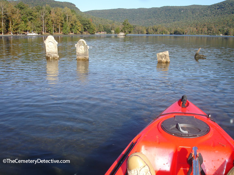
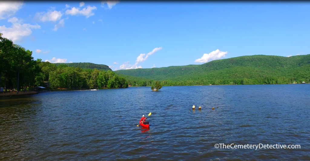 The Submerged Cemetery at Mullins Cove
With the raising of lake levels an additional 5 3/4′ to approximately 634′ MSL, the cemetery was most certainly underwater by 1949 even if it hadn’t been underwater beforehand.
Cemetery Relocation Strategy
TVA has a structured cemetery removal procedure. When TVA builds a dam, they perform an environmental impact study. One component of this study is a search for cemeteries in affected areas. If a new dam is to cause a cemetery’s flooding, TVA will seek family consideration as to whether or not the cemetery or individual grave sites will be moved to an appropriate location. If family members of those buried in the affected cemetery wave the right to have the grave sites moved, TVA respects the family’s wishes. If family agrees to a removal, TVA develops a plan for a respectful relocation of affected grave sites. In fact, TVA has relocated grave sites from more than 550 cemeteries within their river system since their inception in 1933.
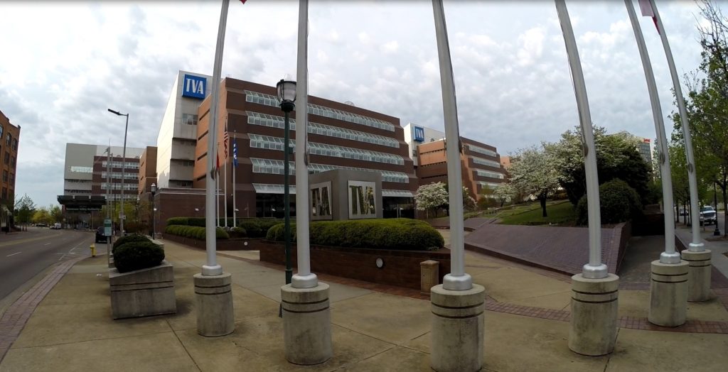 TVA offices in Chattanooga, Tennessee
However, the submerged cemetery at Mullins Cove is a special case.
According to TVA officials, this cemetery was flooded prior to TVA’s involvement with Hales Bar Dam. Because of this, TVA seems to defer to perceived prior agreements that family members would have made with TEPCO.
Superseding the already mentioned reasons why the grave sites were not moved, there is evidence of a 1944 agreement with Long Family descendants. This agreement supposedly provides that the grave sites should remain in place. (I have not, yet, acquired an actual copy of this agreement. I will update this information should I acquire this agreement.)
Hales Bar Dam Failure
When the Chattanooga and Tennessee River Power Company drew up plans to build Hales Bar Dam, they performed many topographical studies. However, significant geological studies were not performed. If current geological models had been available in 1905, engineers would have realized Hales Bar contains a bedrock of Mississipian Age Bangor Limestone. This particular type of Limestone is very susceptible to water erosion and development of subterranean karst formations. The karst formations in the area of Hales Bar form a fractured, cavernous system on and below the riverbed. Hales Bar Dam was built on a faulty foundation. On the very day after Hales Bar Dam filed it reservoir, engineers noticed water bubbling downstream of the dam. The dam was leaking due to the fractured bedrock.
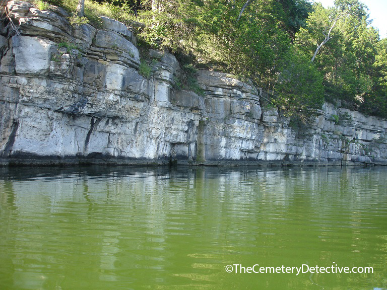 Limestone Was Hales Bar Dam’s Undoing
This leakage was a known problem at the time of the dam’s acquisition by TVA. However, TVA thought they had a solution. Pumping grout into the internal structure of the bedrock would surely plug all the holes and prevent further leakage. Although this repair held, initially, leaks soon returned. At its worst, water was flooding under the dam at a rate of 2000 cu. ft./second. The loss of water was so great that the dam had trouble generating electric power because there was not enough overspill to turn the turbines.
Nickajack Dam Replaces Hales Bar Dam
TVA worked for two decades to repair this problem. By the 1960s, TVA deemed the dam economically unviable. TVA proposed a plan to build a replacement dam 6 miles down river in a more geologically hospitable segment of the Tennessee River. This dam is called Nickajack Dam.
Nickajack dam opened in 1967 and remains in operation today. By September 1968, Hales Bar Dam was dismantled allowing for free river navigation across Hales Bar. Nickajack Dam maintains lake levels at approximately 633 feet MSL give or take a foot or two on a daily basis.
Therefore, the cemetery is at, or very near, surface level year-round.
Although the dam at Hales Bar is no longer in existence, a section of the old lock system and remnants of the powerhouse are still visible.
Zilpha’s Gravestone in Mullins Cove Cemetery
When I began researching the cemetery at Mullins Cove, I found news articles claiming Henry, Sarah, and their child Moses were buried there. However, this just did not check out with my genealogical research.
Although there was a Sarah on the family tree, it did not make sense that Henry would be buried right next to Sarah who was his daughter-in-law.
Initially, I was confused that Henry would be buried next to his daughter-in-law. As I continued to study the gravestones, I discovered that it was not Sarah buried here but was, in fact, Zilpha. The news articles I had read (and still continue to find) made a mistake about this grave site and gravestone.
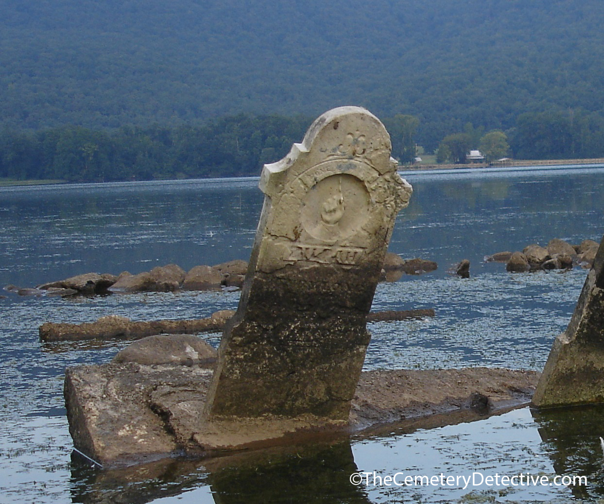 The Submerged Cemetery at Mullins Cove
The years have not been kind to Zilpha’s gravestone. It is almost illegible even in the best of visibility and at times of low lake levels. It is especially difficult to read when the sun is overhead. Many of my first visits to the cemetery were during morning or afternoon hours. However, during these visits, I could never get a truly good read of the inscriptions on the three gravestones. Lighting makes a huge difference in my ability to read a gravestone. So, during late summer of last year, I began visiting the gravestone during the evening hours when the sun was setting just behind Stoker Ridge in an area of the Tennessee River known as Bennett Lake.
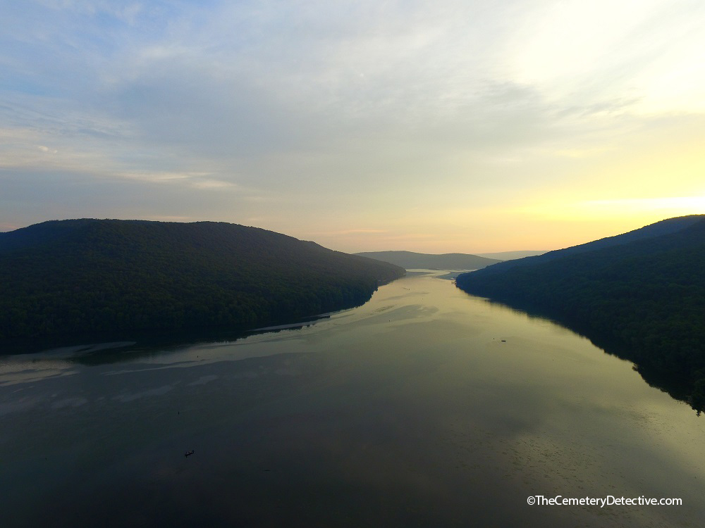 The setting sun helps me read gravestone inscriptions
Now, I need to sidetrack for just a moment to make a point of interest. I normally try to start my day early and visit cemeteries in the morning hours. This time-of-day gives me the best chance of reading inscriptions. A tradition in Upland South cemeteries is that gravestones often face east. Therefore, the rising sun illuminates inscriptions of gravestones. Early morning light makes them easier to read. However, the gravestones in the Mullins Cove cemetery face west.
TVA Fixes Headstones and Protects Long Cemetery
I have no documentation on the original orientation of the gravestones. However, in 1999, in a response to public outcry, TVA righted the gravestones at the same time they built a protective fence of riprap around the perimeter of the cemetery. The gravestones had been tilted for years. Whether or not the gravestones originally faced east is unknown. However, when the gravestones were righted, they were placed facing west. Now, personally, I like the fact that they are facing west. High hilltops rise directly east of the cemetery’s location. Therefore, the face of the early morning rising sun never truly illuminates the gravestones. However, by late summer, when the sun is beginning to move southward on the horizon, its angle as it sets over Stoker Ridge is low enough that the face of the gravestones are aglow with deeply rich September sunsets.
September’s setting sun allows for better reading of all three gravestones. When I began scrutinizing their inscriptions, I slowly realized news accounts of Sarah’s burial here are inaccurate. Zilpha is buried here, not Sarah. There is a curious thing about Zilpha’s gravestone. Zilpha spelled her name ZILPHA. However, the last two letters in Zilpha’s name are transposed AH instead of HA. Since the gravestone is difficult to read, a cursory glance at the last two letters could lead someone to believe that SarAH is buried here. I surmise that someone misidentified the gravestone years ago. Now, when a news agency reports on this cemetery, the misinformation is regurgitated.
After intensive study with many different angles of sunlight and many levels of lake water, I have been able to determine the writings are as follows:
ZILPAH [sic]
wife of
HENRY LONG
BORN
Sep 22 1792
DIED
Oct 04 1860
HENRY LONG
BORN
May 16, 1782
DIED
SEPT. 16 1875
Moses M.
Long
1880 – 1881
According to my genealogical research, Moses Merritt Long is very clearly Henry and Zilpha’s Great Grandson, not Henry and Sarah’s child as some news agencies have reported. Since Moses is buried here, I have often wondered if his parents are also buried beneath the water’s surface.
Aerial Cemetery Photography
Using an aerial videography platform, I have surveyed the entire lake bed in the area of the cemetery looking for other grave sites. Even when lake levels are at their lowest, there are no other apparent submerged grave sites. However, during one of my early scans, I found another cemetery several hundred yards away in a wooded plot on dry land. After paddling to this cemetery, I found many Long family descendants including Moses’ father, James Long. However, there is no sign of Moses Mother, Rhoda Emma Greer Long.
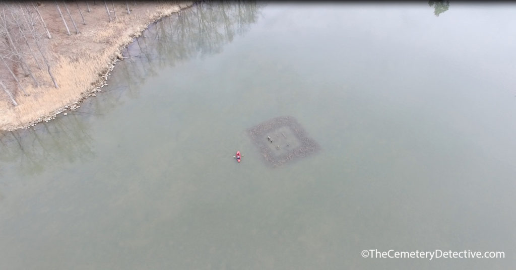 The Submerged Cemetery at Mullins Cove
Rhoda Greer Long gave birth to Moses Merritt Long in November 1880. She named him after her father Moses Greer. Moses Merritt died 3 months later in 1881. After Rhoda’s husband, James, died in 1907, she moved away from Mullins Cove and lived her remaining years in Chattanooga where she died in 1936.
Rhoda Long and Moses Long – A Re-connection
Think about what was happening in 1936 in the area of the Mullins Cove Cemetery. The waters had already risen and were already lapping at the perimeter of the cemetery making it difficult, if not impossible, for Rhoda to visit her son’s grave site. When I thought about that, it made me sad. So, I to took flowers to Rhoda’s grave site in Chattanooga in memory of her son Moses Merritt Long.
Now, I know this probably sounds a little bit crazy, but when I was visiting Rhoda’s grave site, I had this feeling deep within me. I don’t know how to describe it but it was almost as if Rhoda and Moses were aware that I had visited each other’s grave sites and they were, somehow, appreciative of the re-connection.
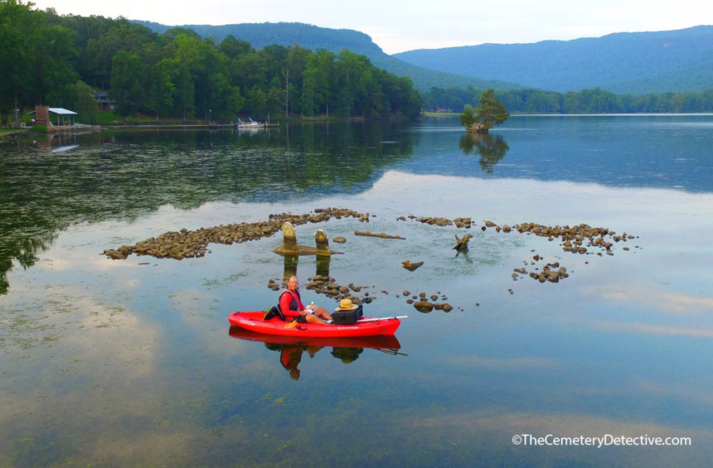 The Submerged Cemetery at Mullins Cove
Timeline:
1782 Henry Long born
1792 Zilpha Long born
1807 Henry Long moves from Jonesborough
1808 Henry Marries Zilpha
1811 Henry Long moves to Mullins Cove
1855 James Long (Henry’s Grandson, Moses’ Father) born
1855 Rhoda Long born
1860 Zilpha Long dies
1875 Henry Long dies
1875 James Marries Rhoda
1880 Moses Merritt Long born
1881 Moses Merritt Long dies
1905 Construction begins on Hales Bar Dam
1907 James Long dies
1913 Hales Bar Dam completed
1920s Flashboards raise lake levels to 629′ MSL
1933 TVA formed
1936 Rhoda dies
1939 TVA acquires Hales Bar Dam
1940 Chickamauga Dam completed
1949 TVA raises lake levels by 5 3/4 feet
1967 Nickajack Dam completed
1968 Hales Bar Dam deconstructed
1999 TVA rights gravestones and builds perimeter of riprap
2014 Keith Harper discovers and becomes fascinated with The Submerged Cemetery at Mullins Cove.
*References and Supporting Documents are Forthcoming.

