Osage Orange (Hedge Apples) as a Cemetery Fence Row

Osage Orange trees used as a fence row in Forest Hills Cemetery Chattanooga, Tennessee

In addition to great sunrises and cooler weather this time of year, I always enjoy finding Osage Orange fruit during early morning autumn walks in my local cemeteries.

Osage Orange Fruit Signifies The Coming Of Autumn

Osage Orange (Maclura Pomifera) were used for generations by Native Americans – particularly the people of the Osage Nation. Workers crafted bows and other weaponry from its sturdy yet flexible wood.

Osage Orange trees tend to grow in dense proximity to one another. Because of this, they are often used as a natural wind break. In the 1930’s 100’s of millions of Osage Orange trees were planted in the plain states to help guard against wind driven soil erosion during the dust bowl years. This resulted in large-scale distribution of the tree.

Cemeteries Use Osage Orange Trees

Because of its widespread use, public entities, such as cemeteries, used the tree as a means of inexpensive, natural perimeter fencing.

The fruit exudes a sticky white latexy substance that was used in olden times as a natural insect repellant. The fruit’s outside has a wrinkly, craggy appearance.

I am always interested in looking for Fibonacci sequences when I’m observing trees and their fruits out in nature but no discernible Fibonacci sequence is readily apparent on the Osage Orange fruit.

Although not as widely used, now, as it was in the early to mid 1900’s, Osage Orange trees are still very commonly found.

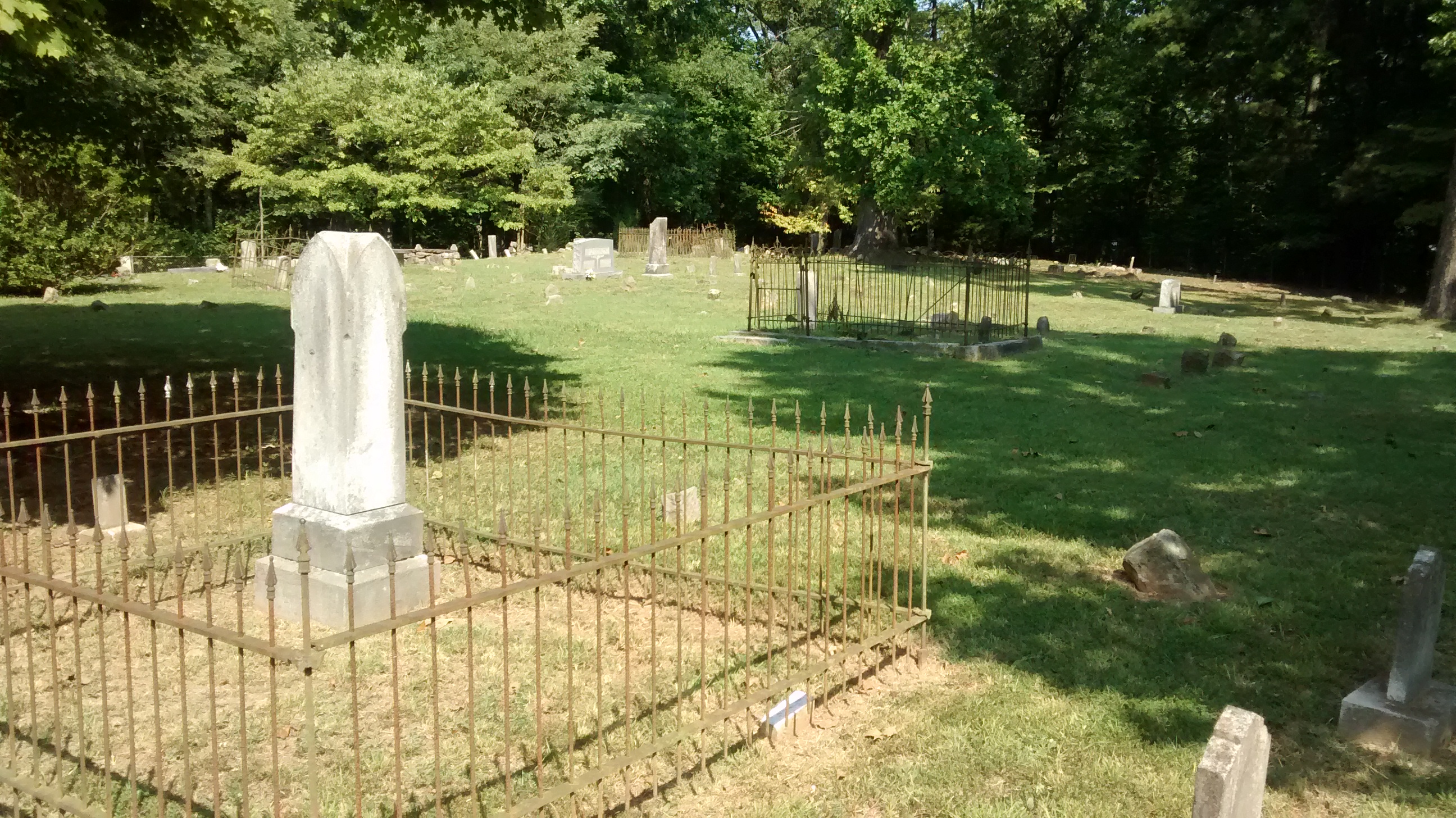
As you can see here, I found quite a few specimens strewn freely on the ground of Forest Hills Cemetery in Chattanooga, Tennessee.

Osage Orange Trees in Cemeteries

References:
http://lancaster.unl.edu/enviro/pest/nebline/hedgeapple.htm
https://en.wikipedia.org/wiki/Maclura_pomifera

“Magic Forest” Kevin MacLeod (incompetech.com)
Licensed under Creative Commons: By Attribution 3.0 License
http://creativecommons.org/licenses/by/3.0/
Forest Hills Cemetery Chattanooga, Tennessee.

State Line Cemetery and the Nickajack Bat Cave

State Line Cemetery was established in the early 1800’s.

A visit to State Line Cemetery

On a recent trip to the Nickajack Bat Cave on the shoreline of the Tennessee River, I discovered a cemetery very near the junction of the Tennessee, Alabama, and Georgia borders.

State Line Cemetery

State Line Cemetery was established in the early 1800’s. This coincides with the era many Euro-Americans were moving into this part of Tennessee. The land was still heavily populated and influenced by Native American culture. However, the political, economic, and cultural landscapes were changing. Additionally, the environmental landscape was changing with farmers beginning to graze livestock in the area.

State Line Cemetery Established Early 1800's

Many of the early gravestones are simple fieldstones laid to mark each gravesite. These early gravestones have no discernable markings thus giving no indication of the name nor date-of-death of the interred. Other grave markers are more modern dating to recent years.

State Line Cemetery Picture

Stateline Cemetery encompasses ground very near the junction point of the Tennessee, Alabama, and Georgia borders. If you wish to visit this junction, park your car at the cemetery and find a trail heading due west. The junction point lies about 100 yards from the westernmost edge of State Line Cemetery.

3 State Border Junction

For added excitement to your cemetery hunting, visit the Nickajack Bat Cave at sunset. The cave can be accessed via the Maple View Public Use Area. Shortly after sunset, thousands of bats exit the cave. They flood the tree tops in search of their nightly meals consisting of various insects.

nickajack-bat-cave-above

There is a short hiking trail leading to an observation platform. If you have a kayak, you viewing will be greatly enhanced as you can kayak right up to the mouth of the cave and watch the bats exit directly overhead.

Nickajack Bat Cave


1) Nickajack Bat Cave

2) TN AL GA Border Junction

Hunt Family Cemetery – Chickamauga, Georgia

The Hunt Family Cemetery on the Grounds of the Chickamauga Battlefield

Hunt Cemetery - Sign

Hunt Cemetery – Chickamauga, Ga.

Approximate Directions: Drive to the parking area at approximately:
lat. 34.896901 lon. -85.244002.
Walk down the gravel road about .4 miles ’til you come to a clearing. There is a yellow blazed trail to your left. If the trail is overgrown (as it was when I last visited) follow the road then bear left as you follow the edge of the pasture land. In about 800 feet, you will see another hay field to your left. Follow the left edge of that pasture and you will come to the Hunt Cemetery in about 500 feet.
The Hunt Cemetery is located at approximately:
lat. 34.892761 lon. -85.241823
If you’re not good with finding your way through overgrown trails or trekking down dirt paths, stop your car at the Chickamauga Battlefield’s Visitor’s Center and ask for a map to the cemetery.

Hunt Cemetery - In the woods

Chickamauga and Chattanooga National Military Park

Deep in the forests of the Chickamauga and Chattanooga National Military Park (commonly referred to as the Chickamauga Battlefield) lies a cemetery of the Hunt family.

The Hunts owned and farmed the land in the years before the famous Battle at Chickamauga. Buried here are several family members in marked graves within a cast iron fence. Outside the fence, numerous field-stone marked and unmarked grave sites can be found within the wooded cemetery. Presumably, these are grave sites of family members and workers of the farm.

Hunt Cemetery - Fenced in area.

M.L. Hunt - Hunt Cemetery

Gravestone of Ann Robison

Gravestone of Helm Hunt